

SBES
SBES are typically carried out to determine the river/sea bed levels accurately in 2D and 3D. The data is typically used by engineers, architects, port authorities, civil contractors and modellers to facilitate developments, planning and monitoring.


Capability
HHS has inverted heavily in the latest survey equipment and processing software in order to achieve the most accurate data possible and to pass on savings to the client as the whole data capture and processing routine workflow is streamlined. HHS primirarely use Trimble R8 GPS and S5 total station which operate as one integrated survey unit, in addition they are easily interfaced to third party devices which maintains the integrity of the data and enables HHS to deliver the highest quality data possible in either digital of hard copy format. The equipment can be quickly setup and calibrated on vessels of opportunity and can be easily allow either GPS or total station to out positional information to be logged.
Service
SBES data sets have a wide range of end users, a typical end use would include:
- Pre & Post dredge surveys
- Monitoring
- Regular depth monitoring surveys in historical problematic areas known to silt up
- River flood surveys
- Water abstraction
- Pipe outfall routes
- Reservoir surveys
- Marine developments, ports marinas, shipping channels
- Settlement ponds
- XYZ data to facilitate hydrodynamic model generation
- Cable routes
- Wind farms
- Scour surveys
MBES
As with many fields of geomatics today clients are looking for more information in order to build a more complete picture of the under sea environment so that they can make better informed decisions based upon real survey data covering 100 % of the sea floor and not just the track line that the boat has passed over as is the case with SBES. MBES offers a more complete richer data set so that a 3D world can be envisaged. In recent time MBES are being utilised in structural scour surveys of bridges, quay walls, wind farm monopiles, cable routes and areas experiencing erosion as a result of mechanical factors-propellers and jet drives form large ships as the structure and surrounding marine bed can be surveyed and modelled in high definition 3D which facilitates better decision making, less interpretation and better monitoring/comparison in the future. In addition SSS can also aid interpretation of the sea bed and its environs as debris can be identified and located- old bridge piles, timber posts, debris and historical repairs.


CAPABILITY
HHS has the ability to undertake MBES for numerous applications and locations having gained considerable/extensive experience in successfully undertaking surveys abroad. The data can either stand alone as a deliverable or can be united with third party data sets to offer a complete environment data set. Surveys are carried out to the highest order and in many cases are only on element of the overall tender as SSS and SBP can also be utilised as can laser scanning. Typically a vessel would be setup and calibrated with a full survey suite of hardware and software to cover all scenarios.
SERVICE
MBES can be utilised in the same operational requirements as SBES, but normally the sea/river bed has 100 % insonification, this allows a higher level of accuracy, less interpretation of data and more realistic modelling. Data is of a higher order of accuracy as it is normally corrected for velocity (SVP), timing, heave pitch & roll, heading and RTK for heighten.
- Pre & Post dredge surveys
- Monitoring
- Regular depth monitoring surveys in historical problematic areas known to silt up
- River flood surveys
- water abstraction
- Pipe outfall routes
- reservoir surveys
- marine developments, ports marinas, shipping channels
- settlement ponds
- XYZ data to facilitate hydrodynamic model generation
- Cable routes
- Wind farms
- Scour surveys
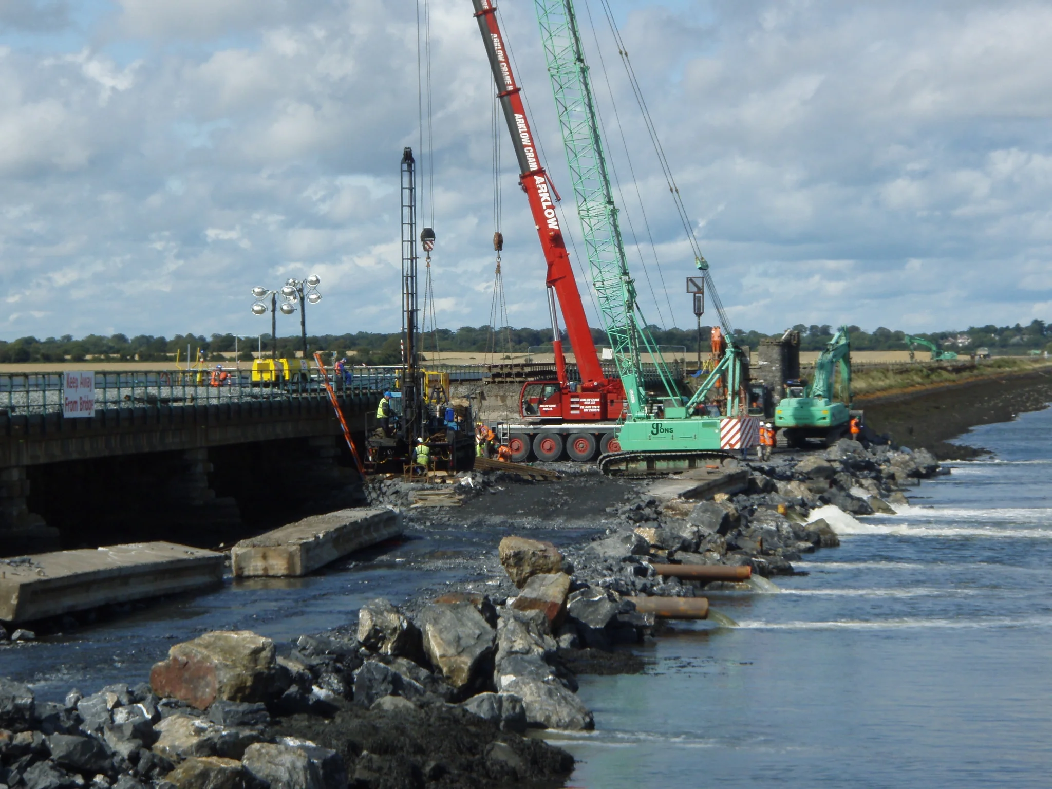
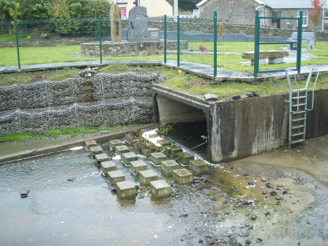
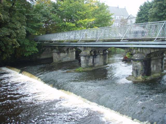
River Flood Surveys & Structural scour surveys
Over the years floods have become a major part of life, in order to minimise the effects organisations are making efforts to reduce the rick to life , property, the environment and infrastructure by building flood relief sechems. In order to accurately predict the effects of floods sophisticated hydrodynamic flood models need to be generated in order to access the situation and design an effective flood relief schemes. One of the basic building blocks of the modelling is surveying river cross sections, more recently proporitories of structures spanning rivers are undertaking structural scour surveys to determine the likelihood/suspability to scour.


CAPABILITY
HHS has the ability and proven track record to carry out a wide range of services that are required in order to fully understand river hydrodynamic for flood related surveys and structural scour monitoring. It is no longer the case that one survey application is suffice to survey river topography and structural integrity, we utilise a wide range of equipment that is easily and rapidly deployed and interfaced to each other to streamline data capture, processing workflows and maintain the highest level of accuracy to capture data/information that third parties can use to make informed decisions and make meaningful comparisons/analytics with future survey data.
SERVICE
The range of services that are on offer all have a proven record to deliver while not all have been used in this particular application we have tailored our approach based upon the clients needs, the structure/river topography and our experience to determine what information can be gained so that informed decisions can be made. The range of services includes
- Single beam echo sounder surveys
- Multibeam echo sounder
- High resolution sonar scanning
- Side scan sonar
- Sub bottom profiling
- Detailed site surveys
- Equipment instillation- visual water level boards and electronic water level gauges
- River cross section surveys for flood relief schemes
- Structure laser scanning
- Rapid response flood surveys
- Threshold surveys
- Reservoir surveys
- Flood defence surveys
- Flood construction setting out